Oyala (Ciudad de la Paz)
Djibloho – Ciudad de la Paz (Djibloho – Ville de Paix, Djibloho – Cidade da Paz), formerly Oyala, is a city in Equatorial Guinea that is being built to replace Malabo as the national capital. Established as an urban district in Wele-Nzas in 2015, it is now the administrative headquarters of Djibloho, Equatorial Guinea's newest province created in 2017, and is located near the town of Mengomeyén. In 2017, the city was officially renamed Ciudad de la Paz ("City of Peace").
The planned city's location was chosen for its easy access and benign climate. It is notably on the mainland, in contrast to Malabo, which is on the island of Bioko. It was designed by the Portuguese Studio for Architecture and Urbanism FAT – Future Architecture Thinking. It is projected to have around 200,000 inhabitants, a new Parliament building, a number of presidential villas and an area of 8150 hectares. The construction of this new capital has been criticised by the political opposition to President Teodoro Obiang, the driving force behind the initiative. The Government of Equatorial Guinea began to move to the city in early 2017.
The planned city's location was chosen for its easy access and benign climate. It is notably on the mainland, in contrast to Malabo, which is on the island of Bioko. It was designed by the Portuguese Studio for Architecture and Urbanism FAT – Future Architecture Thinking. It is projected to have around 200,000 inhabitants, a new Parliament building, a number of presidential villas and an area of 8150 hectares. The construction of this new capital has been criticised by the political opposition to President Teodoro Obiang, the driving force behind the initiative. The Government of Equatorial Guinea began to move to the city in early 2017.
Map - Oyala (Ciudad de la Paz)
Map
Country - Equatorial_Guinea
 |
 |
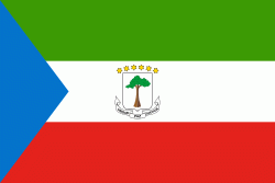
| Flag of Equatorial Guinea | |
Equatorial Guinea consists of two parts, an insular and a mainland region. The insular region consists of the islands of Bioko (formerly Fernando Pó) in the Gulf of Guinea and Annobón, a small volcanic island which is the only part of the country south of the equator. Bioko Island is the northernmost part of Equatorial Guinea and is the site of the country's capital, Malabo. The Portuguese-speaking island nation of São Tomé and Príncipe is located between Bioko and Annobón. The mainland region, Río Muni, is bordered by Cameroon on the north and Gabon on the south and east. It is the location of Bata, Equatorial Guinea's largest city, and Ciudad de la Paz, the country's planned future capital. Rio Muni also includes several small offshore islands, such as Corisco, Elobey Grande, and Elobey Chico. The country is a member of the African Union, Francophonie, OPEC and the CPLP.
Currency / Language
| ISO | Currency | Symbol | Significant figures |
|---|---|---|---|
| XAF | Central African CFA franc | Fr | 0 |
| ISO | Language |
|---|---|
| FR | French language |
| ES | Spanish language |


